|
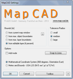
Bounds
| • | From current map window: The bounds are determined according to the area visible in the current map window (bounds are three times the size of the window). Highest accuracy. |
| • | From max. object boundaries: The bounds of all existing objects over all layers in the map window are used (the cosmetic layer and raster layers are not considered). Middle accuracy. |
| • | From max. layer boundaries: The bounds of the largest layer in the active map window are used (the cosmetic layer and raster layers are not considered).Lowest accuracy |
| • | From editable layer: The bounds of the editable layer are used. If no layer is editable the max. boundaries of all layers are used. |
If Latitude/Longitude projection is enabled or only raster layers are opened, then the boundary settings are disabled.
Tolerance Radius
To be able to exactly snap to an object, you can choose between three cursor sizes: small / medium / large
Add node
Can be used as the default setting for some MapCAD functions. If the option is checked, the Perpendicular and Right Angle functions convert rectangles into region objects. Optionally, you can define if additional nodes will be inserted in the reference layer where objects are snapped to (Snap to Lines).
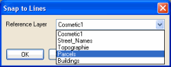
Snap to Lines
Define the desired reference layer. All layers that are set to selectable will be provided. Enabling the Add Node option inserts nodes in the reference layer at the intersection. See also: Snap to Lines
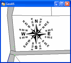
Mathematical Coordinate System (360 degrees)
Orientation East, counter clockwise. This is the default setting.
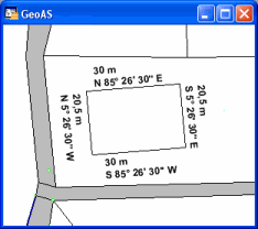
Metes and Bounds – USA LSS (N/S xxx° yy’ zz’’ E/W)
Enabling this option, the functions Create Line/Polyline, Polar Append, Calculate Direction and Move will be executed by using compass-like settings.
Orientation North-East (N xxx° yy’ zz’’ E) clockwise
Orientation North-West (N xxx° yy’ zz’’ W) counter clockwise
Orientation South-West (S xxx° yy’ zz’’ W) clockwise
Orientation South-East (S xxx° yy’ zz’’ E) counter clockwise
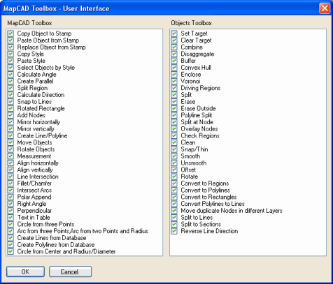
Toolbox
Enable or disable the desired functions
|